


Voting District 1638166000009, Wayne County, Michigan
About
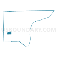
Outline

Summary
| Unique Area Identifier | 600417 |
| Name | Voting District 1638166000009 |
| County | Wayne County |
| State | Michigan |
| Area (square miles) | 4.95 |
| Land Area (square miles) | 4.89 |
| Water Area (square miles) | 0.06 |
| % of Land Area | 98.84 |
| % of Water Area | 1.16 |
| Latitude of the Internal Point | 42.19146260 |
| Longtitude of the Internal Point | -83.45370200 |
Maps


Graphs
Select a template below for downloading or customizing gragh for Voting District 1638166000009, Wayne County, Michigan


Neighbors
Neighoring Voting District (by Name) Neighboring Voting District on the Map
- Voting District 1630702000002, Wayne County, MI
- Voting District 1634004000001, Wayne County, MI
- Voting District 1636942000007, Wayne County, MI
- Voting District 1636942000011, Wayne County, MI
- Voting District 1636942000013, Wayne County, MI
- Voting District 1637736000006, Wayne County, MI
- Voting District 1638166000007, Wayne County, MI
- Voting District 1638166000008, Wayne County, MI
- Voting District 1638166000010, Wayne County, MI
Top 10 Neighboring County Subdivision (by Population) Neighboring County Subdivision on the Map
- Van Buren charter township, Wayne County, MI (28,821)
- Romulus city, Wayne County, MI (23,989)
- Huron charter township, Wayne County, MI (15,879)
- Sumpter township, Wayne County, MI (9,549)
- Belleville city, Wayne County, MI (3,991)
Top 10 Neighboring Place (by Population) Neighboring Place on the Map
Top 10 Neighboring Unified School District (by Population) Neighboring Unified School District on the Map
- Van Buren Public Schools, MI (47,817)
- Romulus Community Schools, MI (23,103)
- Huron School District, MI (13,838)
Top 10 Neighboring State Legislative District Lower Chamber (by Population) Neighboring State Legislative District Lower Chamber on the Map
- State House District 21, MI (110,142)
- State House District 23, MI (97,124)
- State House District 22, MI (87,120)
Top 10 Neighboring State Legislative District Upper Chamber (by Population) Neighboring State Legislative District Upper Chamber on the Map
Top 10 Neighboring 111th Congressional District (by Population) Neighboring 111th Congressional District on the Map
Top 10 Neighboring Census Tract (by Population) Neighboring Census Tract on the Map
- Census Tract 5905, Wayne County, MI (6,278)
- Census Tract 5894, Wayne County, MI (5,839)
- Census Tract 5883, Wayne County, MI (5,439)
- Census Tract 5884, Wayne County, MI (5,359)
- Census Tract 5870, Wayne County, MI (3,993)
- Census Tract 5893, Wayne County, MI (3,710)
- Census Tract 5863, Wayne County, MI (2,040)